So at noon on Sunday she shows up at my house. I show her the map of the 5 routes that I have found that people usually take up the mountain. Of course, I have no desire to take the "easy" route that most people take. We end up choosing to take the "Northwest" ridge route. Supposudly it is not the easiest way up, but it is not the hardest either.
We drive up to the Glennalps trailhead. It is a beautiful day so parking is horrible. After driving around the parking lot for a while and watching people who got there after me slip into spots, I get impaitent and make my own place at the end of one of the rows. We get out of the truck and start toward powerline pass. We have a nice downhill walk for a bit before we have our first turn to make. I follow the signs to Williwa Lake trail. We cross a bridge and continue on a boardwalk before we start to go up.
I spot the obvious trail on the saddle between Little O Malley and False Peak and head toward it. Some guy warns us that there is a moose up around the corner. I pick a little side trail to try to avoid it. 50 feet later, we run into the moose having a snack. I pull out my bear spray, hey it will work on moose too, right? Luckily, he moves along pretty fast and we skirt around him with no msihaphs. We scramble up the trail and in 45 minutes, we have reached the turnoff to the ridgeline.
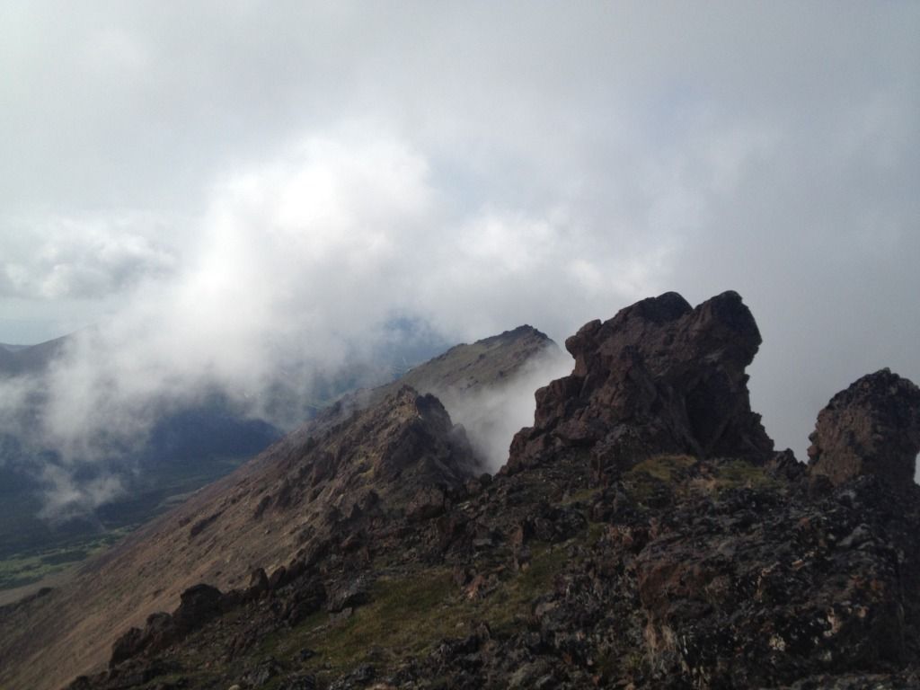
The ridgeline starts off decievingly easy. There are a few little rocks and a nice trail to follow. However, we reach the first peak and are faced with craggy rocks all over and no obvious trail. My approach to the situation is up and over the rocks. Chealsea is not so excited about this idea so I let her lead, assuming (correctly) that she will probably pick a safer route. We slowly make our way to the left of the rocks down and around the false peak. On the other side, we pick up the trail. In hindsight, we can see that it went around the other side of the peak.
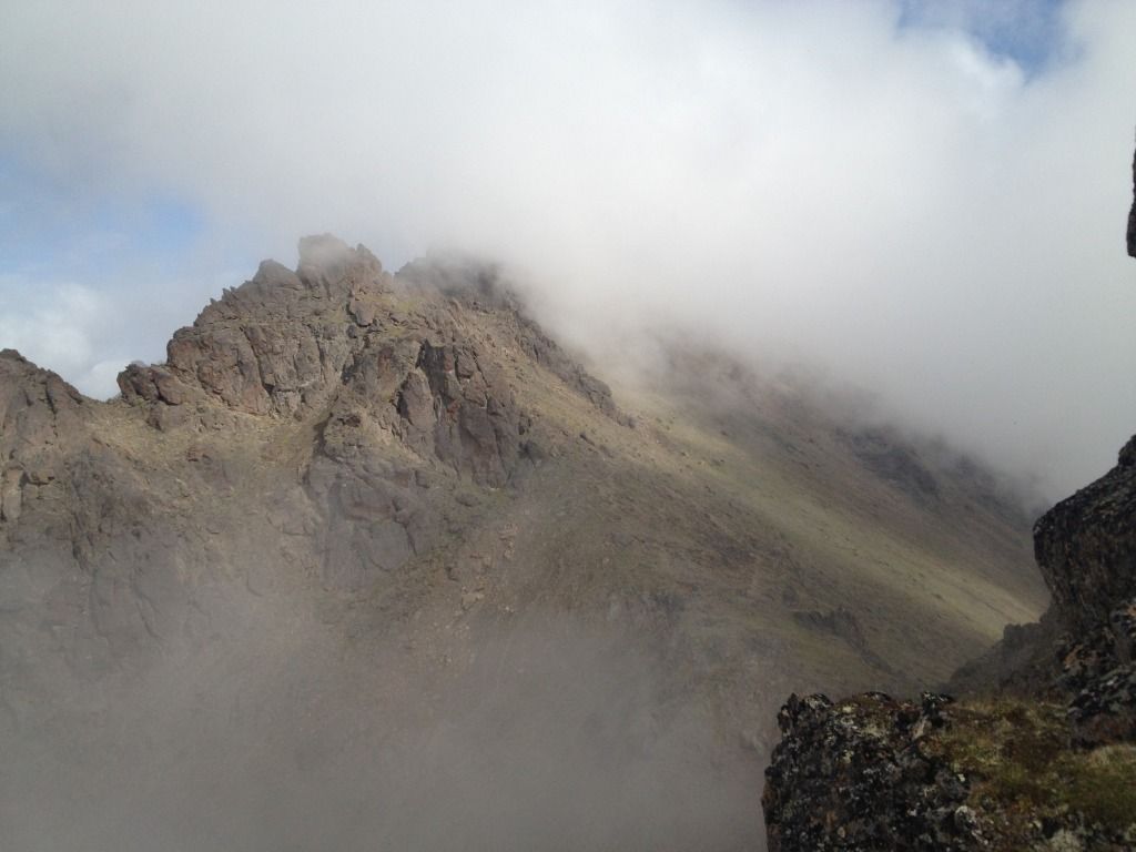
After many cycles of losing the trail, carefully treading over the rocks to get around the false peak, finding the trail again on the other side of the peak, and then seeing yet another peak in front of us, more ominous looking than the last, we lose the trail for good. (One of these peaks is a peak that is actually called "False Peak" FYI...) Being the adventurers that we are, we keep pushing forward, assuming the trail will manifest itself in front of us like it has before. No luck. I decide to may a carron in case other people have the same experience and are not so tenacious. I wonder if anyone has been this way in a long time. Or ever. Chealsea concludes that whomever was making the trail must have been teleporting. There has only been an actual thing resembeling a trail about a third of the way. I mean this is fine with me, I know the direction we are going and can see Flattop and the way back to my truck so I am not too concerned.
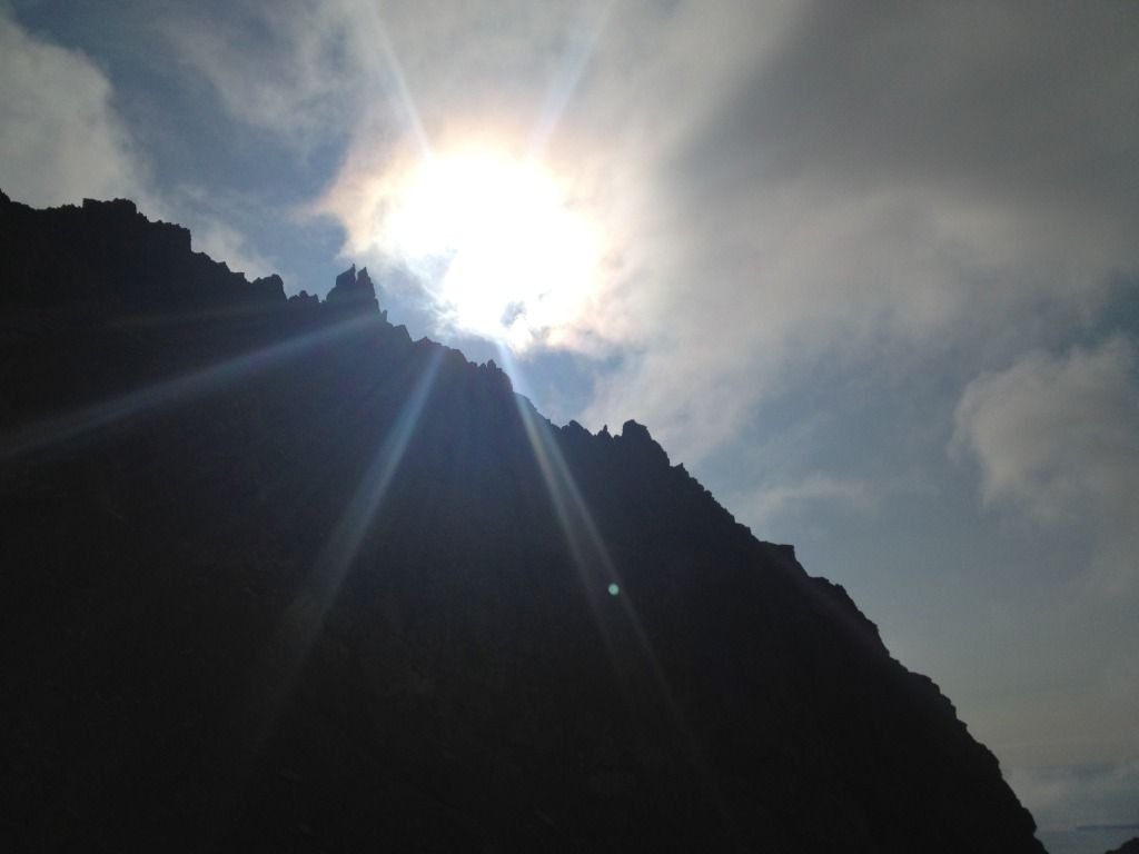
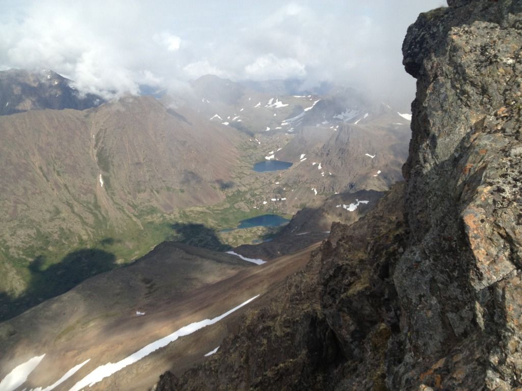
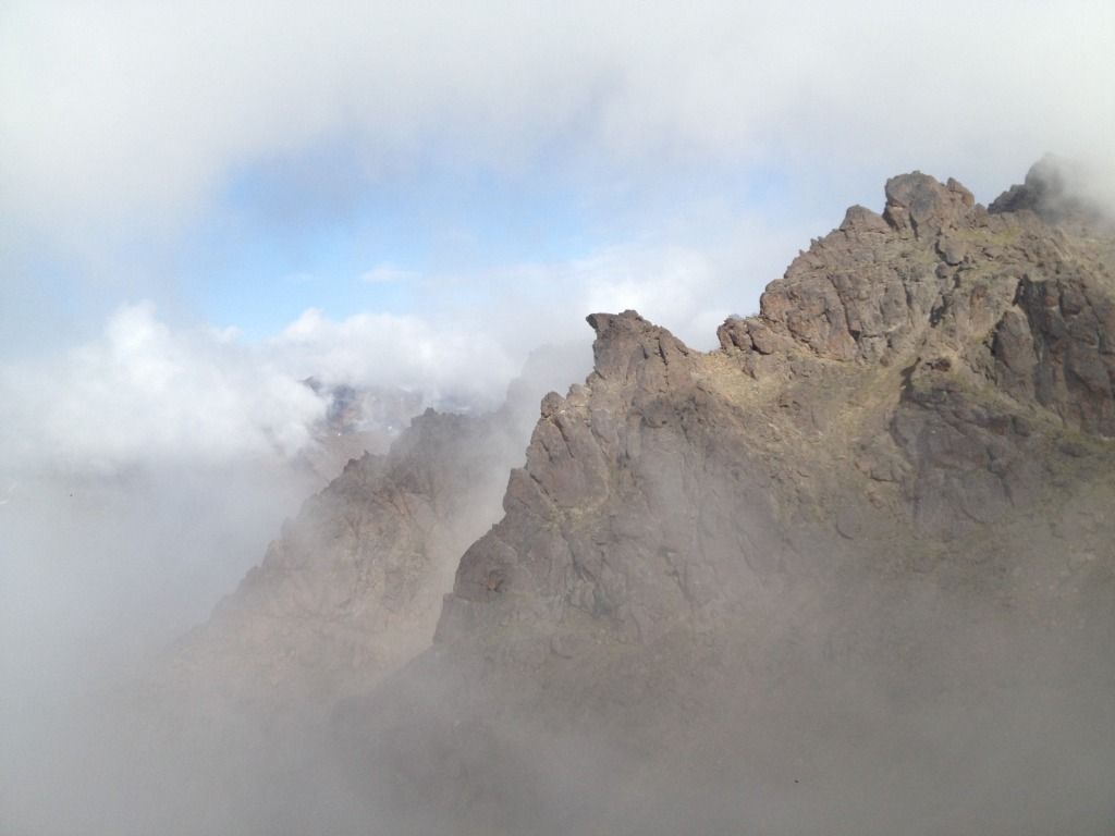
It might have been a little easier if there were no clouds up where we were. It is a beautiful day, but the mountain tops have some clouds on them. (I actually end up a little sun burned) We can see the main trail below us. When there are no clouds. Unfortunately, at the time we lost the trail, there were a lot of clouds. Just when we were starting to get concerned that we had missed something, we see a saddle in front of us. And it looks like another trail joins the ridge we are on! I look at the map. Yes! That appears to be the main route. Or the Northeast Ridge route. Or some route on the map... It is a little hard to tell which is which with the lowered visibility.
We even see other people walking along the trail! Awesome!! 3 hours into the hike, we head down to the saddle and merge back on to the main trail. We see a guy hiking a little ways in front of us and follow him. The trail is about as fragmented as the one we were on before. We would pick it up for a hundred feet or so before losing it again. At this point, I am leading and pick a new approach: head up. I lose the guy in front of us behind some rocks, never to find him again. Weird, I wonder where he went....
After some trail making and a few more false peaks, we finally come to a rock that is taller than all the rest. I scramble over to the surrounding rocks to make sure they really are lower and it is not just my perspective. Well, it is unmarked but it is definately the highest rock for miles and it shows signs of wear... this must be it! Finally, exactly 4 hours into the hike, we make it!
We have a snack and talk about how badass we are for taking the sweet ridge route before heading back. We decide to take the main trail through "The Ballfield" We have had enough rock scrambling for one day. We make it back to the saddle with no major problems. Descending from the saddle is fun though. A few hundred feet of loose scree. We both fall a few times trying to get down. Why would anyone want to go up this?!?! Our route was SO MUCH better. And more fun.
We make it to the bottom of the saddle, only a little more dirty than before. There is no obvious trail. Awesome. We pick a path that seems to be the right direction. The rocks here look like people have walked on them, right?? I am starting to see a pattern in my mountain experiences... (read about east twin peak :) ) We do eventually find a nice path to follow which leads us back to the turnoff we took to get on the ridge.
The whole valley that this alternate path was in is really cool. It is called the ballfield and is just covered in rocks. Some of them fell from the mountains, but it looks like a lot were deposited by glaicers. The sides of the mountains are almost perfectly smooth until about a thousand feet up, where they become all jagged. It looks like a glaicer just came through, scraped off the sides of the mountains, and deposited a bunch of rocks and silt in weird mounds. Accodding to Chealsea, it kind of looks like Mars, but greener. Also, there are a few large boulders in the area, which look like they might be good for bouldering. If anyone more interested in bouldering than sport climbing actually reads this and is interested...... Walking along it, we could see just how long and awesome looking the ridge we took is. From below, we could see two people start down the ridge path before turning around.
Continuing on, we slide carefuly down the slope toward powerline pass, seeing more and more people as we go. We cross over the bridge and are on the final streach home! Some random guys decide to ask about our hike. "So like, where did you go?" "O'Malley" "Is that like, that peak over there?" They point in the right direction. All you can see from this angle is False Peak. "Kinda, we went like 4 peaks past that one" They are properly impressed. We wish each other a good day and continue on.
10 minutes later, we are back at my truck, which is looking rather lonely in the emptying parking lot. Luckily, I have not been towed or ticketed! Overall, an excellent hike. about 7 hours total. The rock scrambling was fun but less terrifying than that of East Twin Peak. I will post up some pictures when I get back from Chignik Bay and have my phone again.... :D And then I will blog about Chignik Bay (part 1)!!! Be excited?!?!
For the webpage where I got most of my info for the hike.... click here! Really, it's good info!
Edit: Pictures! In no particular order... views of the foggy ridge and from the top and such :)
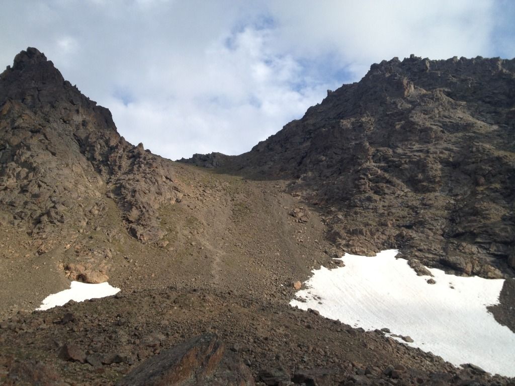 |
| Normal route up that doesnt look so fun... |
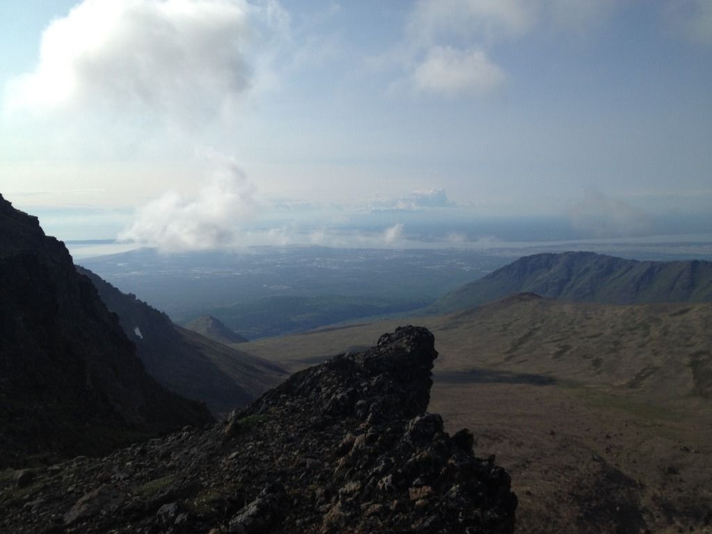 | ||
| Anchorage from the ridge |
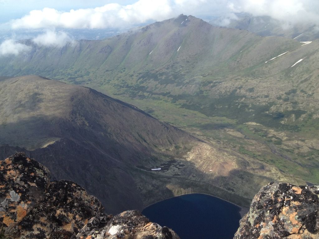 |
| from the top |
 |
| from the top |
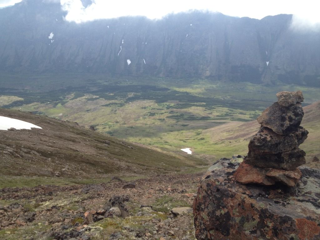 |
| Carron |
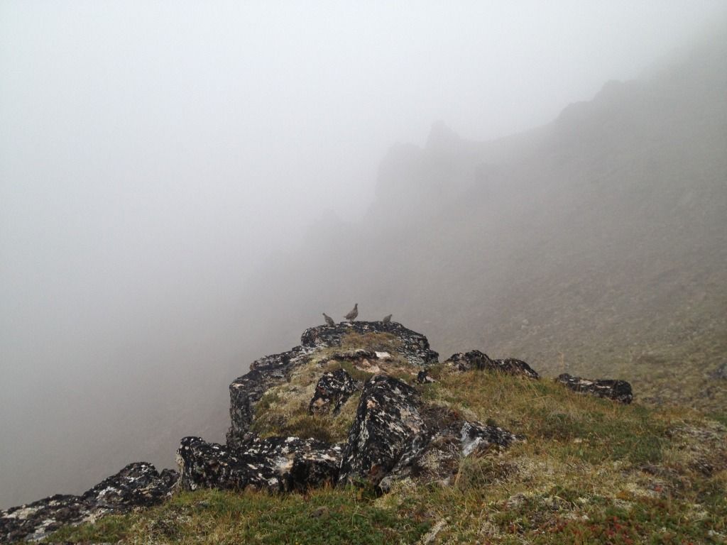 |
| Ptarmigan! |
No comments:
Post a Comment